
By the second half of the 19th century Ilkley had become famous as an inland spa for its pure cold water, fresh air and beautiful landscape. Before then the little village of Ilkley was huddled around the Anglo-Saxon All Saints Church with its 15th century tower (mentioned in the Norman Domesday Book).
White Wells had offered renovated baths since the 1790s with a charity bath-house from 1829. By the end of the 1850s these bath-houses each had a roof and donkeys were available to ride up to White Wells via Wells Road.
The first new purpose-built Hydro - the Ben Rhydding Hydro - was a mile beyond Ilkley at Wheatley, with its cold water treatments, healthy food, exercise regime and consultations with Dr. William McLeod. As Ilkley became a place to visit and live, a stream down from the moor was culverted in 1854 to create Brook Street. Wells House Hydro opened in 1856 and many Hydros of differing sizes followed.
(note – an * indicates that there is a blue plaque on the building)
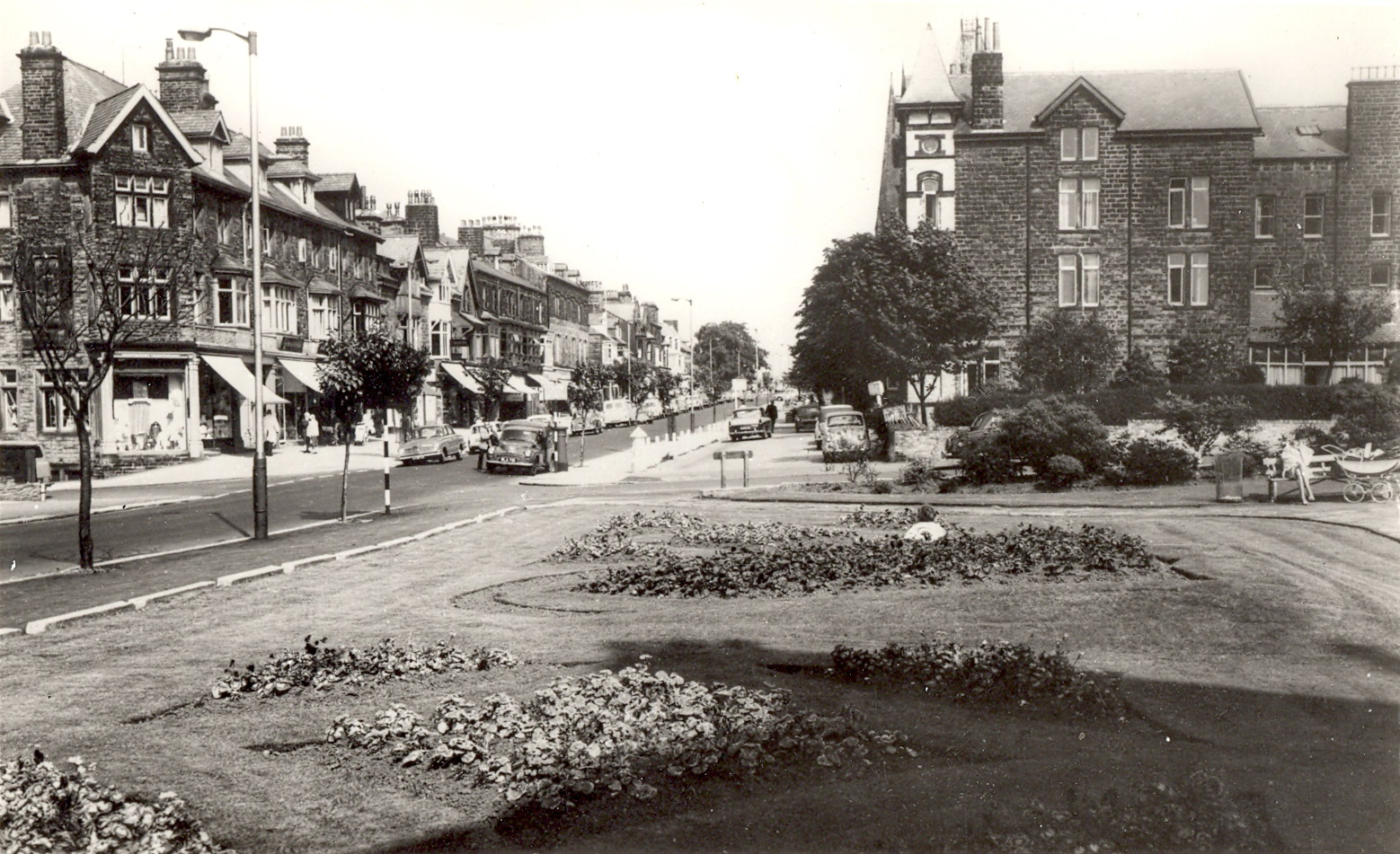
1. Start at Ilkley Town Hall*. Opened in 1908, across from the railway station which had been built in 1870.
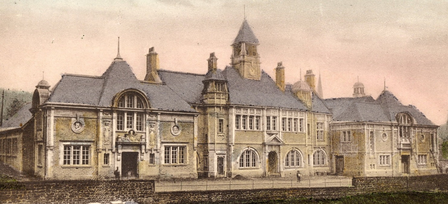 Drawing of the town hall
2. Turn left, cross Wells Road and then walk up Wells Promenade. This once-gated road was built at the end of the 1860s. The buildings were houses on the Wells Promenade side and shops on the Wells Road side. Further up is Guardian Court, the site of the 1870 Wesleyan Church, whose top boundary wall remains.
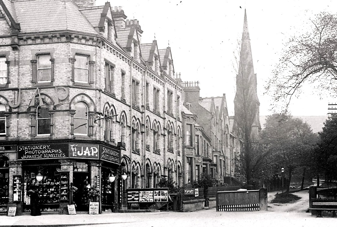 Wells Promenade with gates
3. Turn left in front of Chapel House*, built in 1903 as the Wesleyan Assembly Hall, now apartments.
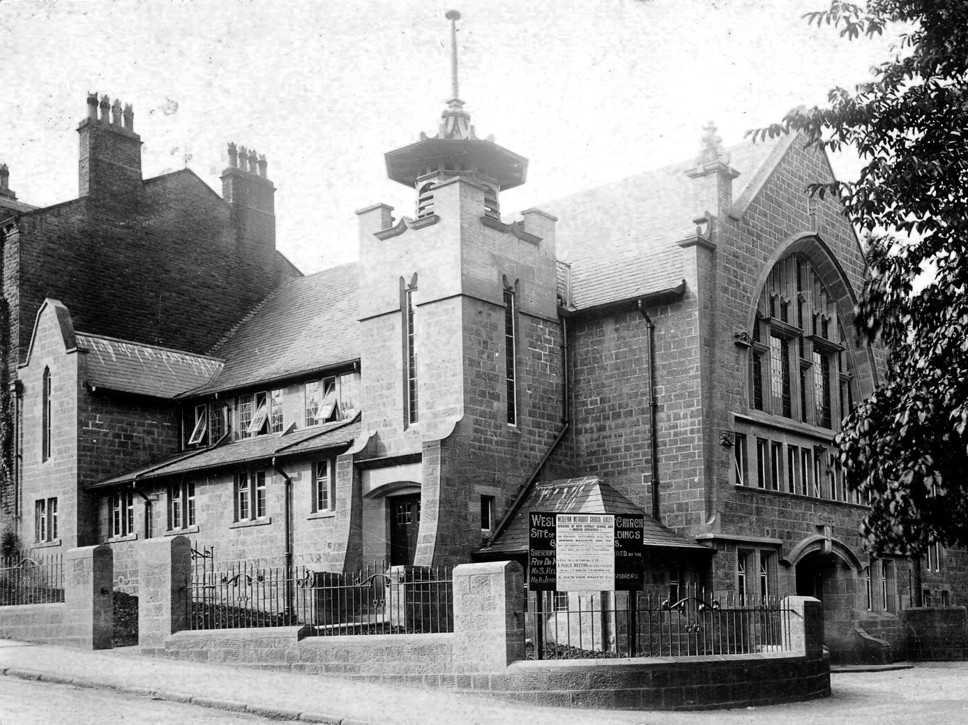 Assembly Hall
4. Turn right, cross over to walk up Wells Road, On the right Wells Court, site of 1870 Royal Hotel and then West View, gentlemen’s residences and lodging houses from the 1840s. Next is West View House (The Heath) 1860, an 1868 semi and The Rombalds*. At the top Moor Cottage was an old farmhouse.
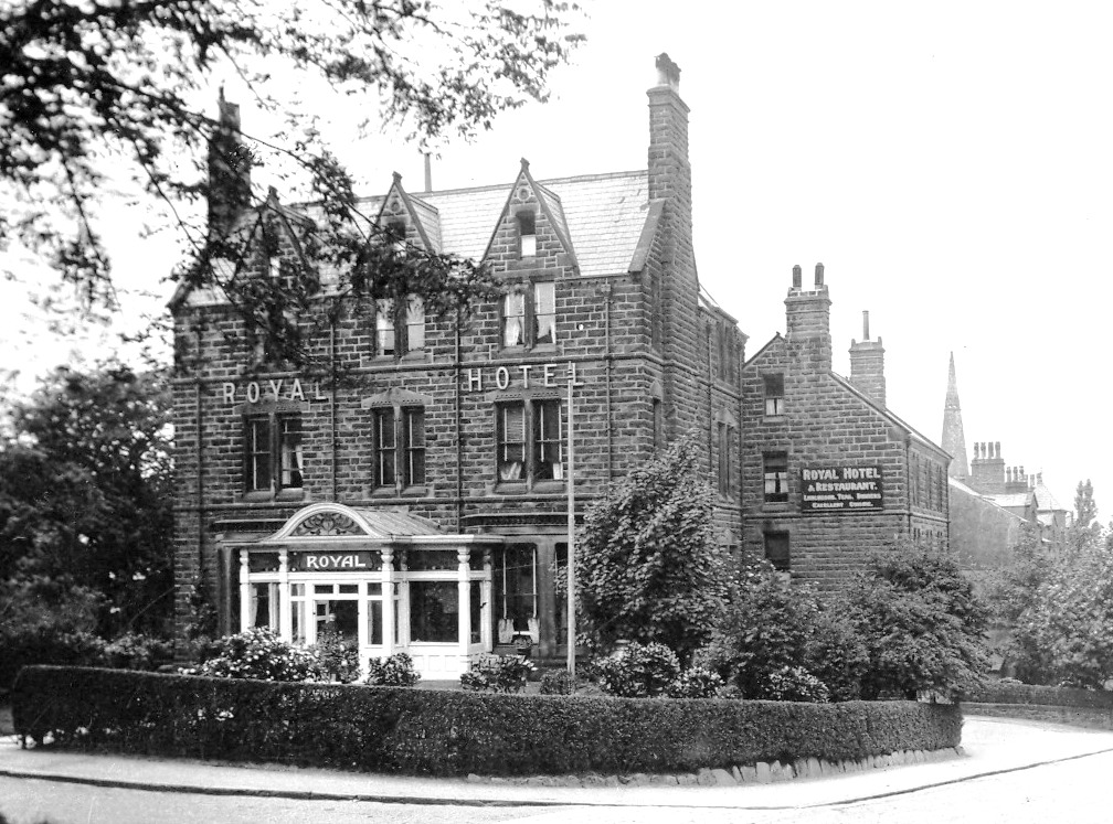 Royal Hotel, now replaced by apartments
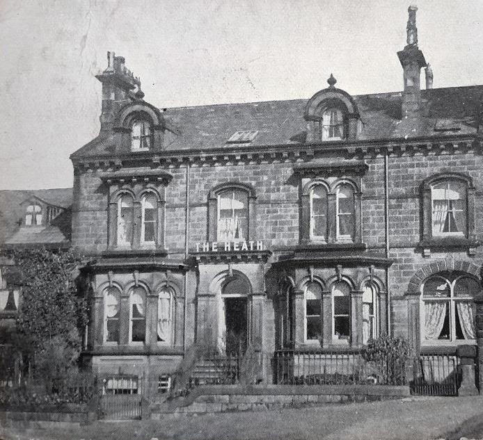 West View House
5. Turn left to walk along Crossbeck Road. South View, was once a lodging house. Opposite is Wells Terrace (renamed Hillside*). Then on the right a series of 1860s houses including Crossbeck House and Terrace. Below on the left are the grounds of Ilkley Hall built in the late 1820s for Joshua Dixon, a Wakefield lawyer. Further along on the right is the Troutbeck Hydro opened 1862 (note the jumping fish on the gable). Then comes Craiglands Park, site of 1860s houses which were converted in the 1890s to the Moorlands Hydro.
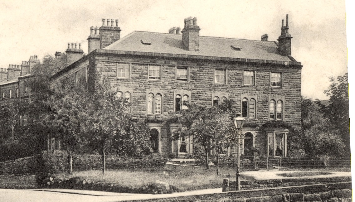 Wells Terrace, renamed Hillside
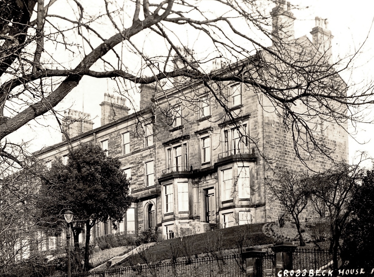 Crossbeck
6. Turn right up the drive to Craiglands, and walk along path to reach Cowpasture Road. Craiglands* is the only surviving hydro hotel. It now has a new 21st century spa.
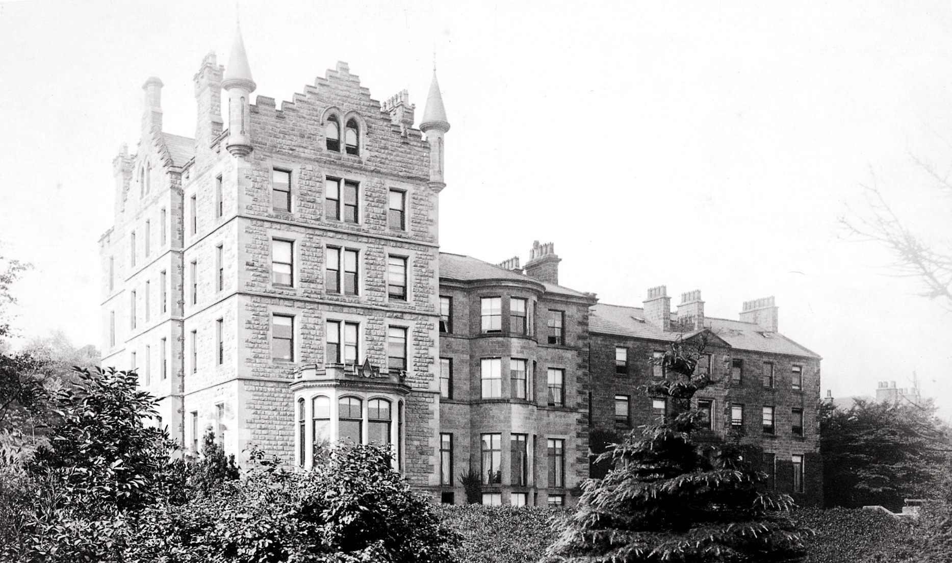 Craiglands before the later additions
7. Back on Cowpasture Road, turn right and then immediately right again and walk up the path to and through the gate at the top. Either walk up the steps to the rough path or right up sloping path which ends with some steps up to the Tarn. Built in 1874, financed by public subscription, and replacing Craig's Dam, it once had fountains and was much used by skaters in winter.
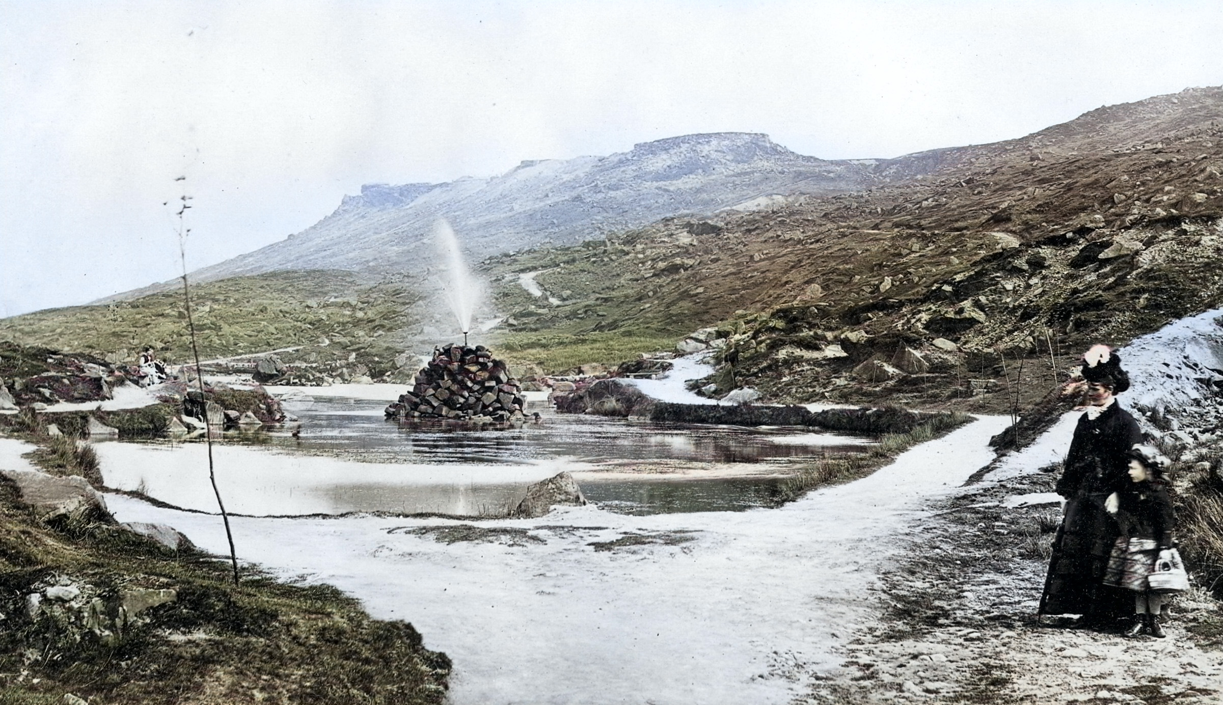 The fountain on the Tarn
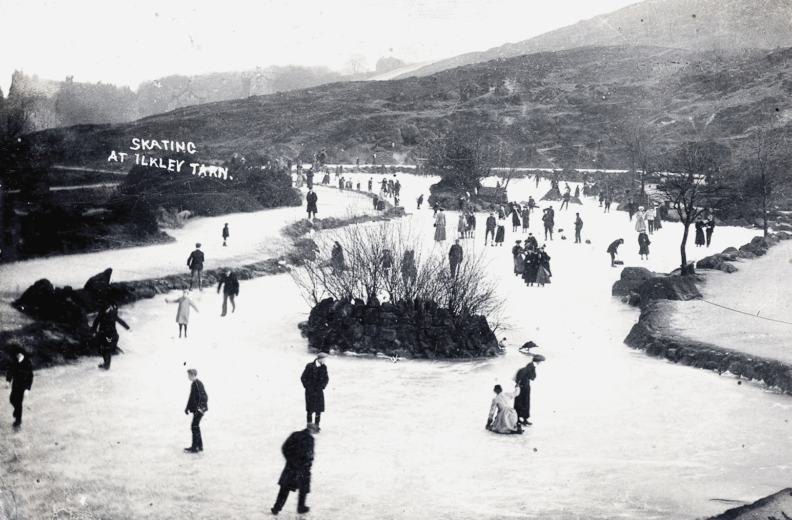 Skating on the tarn
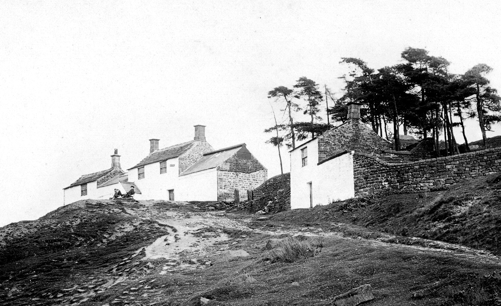
8. The White Wells bathhouse is further up the moor. There are a number of paths that lead to White Wells. White Wells new baths were built in the 1790s by Squire Middelton. There is still a drinking fountain behind. Flags fly when the small café (cash only) and bath-house museum are open. The smaller 1829 Charity Bath-house is just beyond White Wells.
 White Wells and Charity Baths
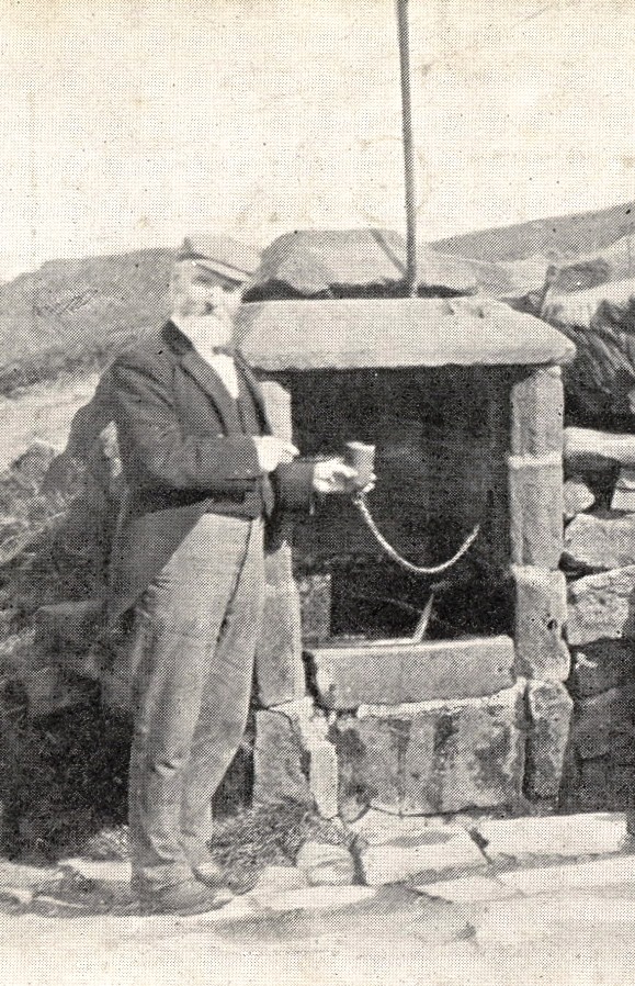 The drinking fountain behind White Wells
9. After enjoying the splendid views over the town and, to the left, up Wharfedale, walk down the gravel path which crosses a stream and then descends to Wells Road.
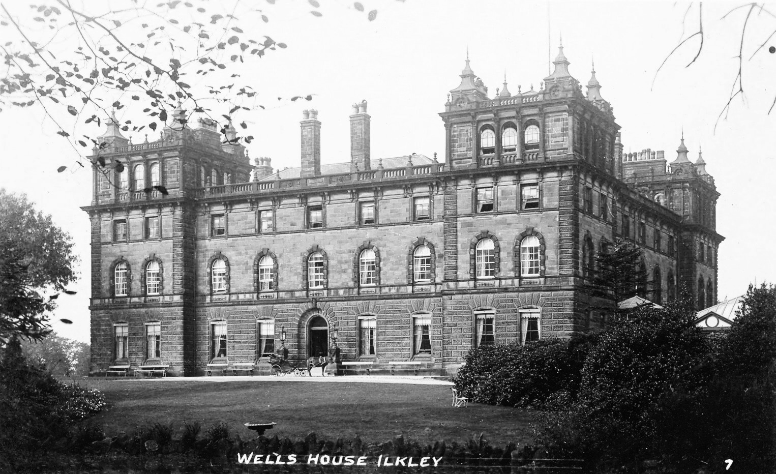
10. Turn right onto Wells Road to walk down to Broderick Drive on the left and to the large stone at the entrance to Wells House*. This former hydro is now apartments and the grounds are private. Since its erection in 1856 as a hydro it has also been a hotel, a wool control centre during the war, a hostel for foreign workers, a school for domestic education (the pud school) and finally high quality apartments.
11. Continue to walk down to Darwin Gardens Millennium Green. Based on themes of evolution and regeneration, the area comprises wildlife-friendly landscaping, recreational features, community-based artwork, and links to Ilkley’s association with Charles Darwin. The car park is the site of West View Bandstand, constructed in 1904 but removed in 1950s.
12. Walk down Wells Road. Set back on the left is a pair of houses by the entrance to Wells House stables. Back on Wells Road, the hollow by the first of a pair of 1870's houses is a former mill pond. Cross Queens Road. The upper corn mill stood here.
 View down Wells Road with the upper corn mill
 Mill pond on Wells Road now filled in
13. Enter Mill Ghyll and walk down the path. In the middle of this Ghyll was the lower corn mill which was demolished in 1873. The stone from the mill was used to edge the paths. William Middelton leased this narrow strip of land to the Local Board in 1873 at a rent of one shilling per annum.
 Lower Corn Mill
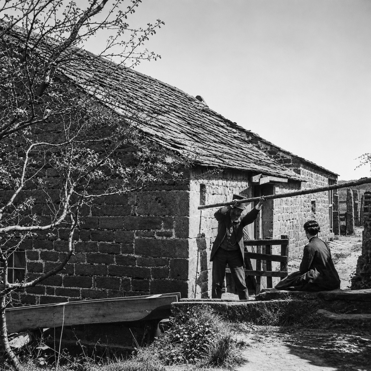 Lower corn Mill with tenants
14. At the bottom of the Ghyll, the brook goes into a culvert. Just before the main road is a large water fountain. This has replaced the original fountain built in 1875 by public subscription for £135. The new gravity-fed fountain’s design was created to reflect the sphagnum moss which is found in abundance on Ilkley Moor. It was opened in 2025 by Alan Titchmarsh.
 The Former Brook Street fountain

A Self-guided Walk: Ilkley’s Artisan Town
A walk below the railway track including the railway town conservation area. A condition of the 1867 land sales, land below the railway could be used for business so smaller terraced houses, lodging houses, workshops, smithies and builders’ yards were built.
1. Start at Ilkley Manor House, Castle Yard, Church Street (*blue plaque). Walk onto Church Street through the arch, turn left, then onto the path beside All Saints churchyard towards New Brook Street. All Saints, Anglo-Saxon church mentioned in the Domesday Book, it has a 15th century tower and 19th century south extension.
2. Go down the steps, turn left, walk down then cross New Brook Street to walk along Castle Road. Pass the late 20th century Castle Gate apartments to Ilkley Playhouse (*blue plaque)
3. Turn right and walk up Weston Road to the Pinfold (*blue plaque). When this street was built in 1870s the old Smithy was demolished and some Roman remains were found, possibly from baths.
4. Walk back towards the Playhouse then cross the road and turn right to walk along Wharfe View Road, passing Margaret Court on your left, built as a convalescent home in 1870s, later it was an orphanage for girls from the Otley Workhouse.
5. Continue down Wharfe View Road. At the end of the road on your right is Tower Court (*blue plaque) - the former 1872 National School, All Saints Junior School. The house with the tower was originally lived in by the headmaster.
6. Continue to end of Wharfe View Road to Leeds Road. On the left the car park was the site of the 1876 Primitive Methodist Chapel. When this closed in 1969 the congregation joined Wells Road Methodist Church.
7. At A65 Leeds Road. Look across the road – The Operatic House was built in 1899 as The Parish Institute - a hall and Sunday School for All Saints Church. To its right Walton’s and Ilkley Cinema were built for the Leeds Industrial Co-op Society in 1899. To the left is Booth’s Supermarket built on the site of the 1872 new Gas Works bought by Ilkley Urban District Council in 1893.
8. Turn left and walk to the traffic lights, cross Leeds Road and cross Lower Wellington Road, then continue along Leeds Road pavement. Booths stone wall was built by the Gasworks Company. Over the A65 is All Saints Court built on the site of 1894 All Saints Infant School. Also across the A65, after Bath Street, the stone-built Ash Terrace is part of an 1875 building club of 81 houses built by the architect George Smith. [Inspired by Saltaire].
9. Continue along Leeds Road. The Drill Hall (*blue plaque) is on your right. This stone building was the base for the Saturday voluntary soldiers and first aid classes. The Drill Hall Yard at the back is now a light industrial estate.
10. Continue down Leeds Road to the pelican crossing. Turn right to walk up Dean Street. On the corner the modern housing block is on the site of the 1901 Leeds Road Congregational Hall which closed in 1970. Dean Street is one of many terraced streets built between 1867 and 1912 by the Dean Brothers, a second generation of Ilkley builders. Across the top of the road is a hedge behind which is a former farmhouse.
11. Turn right on to East Parade. Here are Edwardian terraces. At its far end is the industrial estate including Drill Hall yard.
12. Turn left to walk up North Parade. A row of terraces is on the west/right side with a long-established fish shop at the top. On the left was a field where houses were developed through the 1900s. At the top of the field a PSA Hall was set up in 1902. The PSA - Pleasant Sunday Afternoon - movement was a non-conformist temperance evangelical outreach to working people, with many self-improvement classes and sports. In 1936 the Salvation Army took it over.
13. At the top of North Parade cross Little Lane and walk up Brewery Road to the top. The houses on the left were built in the 1890s. The terrace houses on the right, with stone arches over each door, were built in the 1870s for the Brewery Company. To take advantage of the water supply available here, the Ilkley Brewery and Aerated Water Company started in 1873 and these houses were built by Bradford architect Samuel Jackson. The brewery closed in the 1920s and became a base for local companies. During WW2 Daltons cereal flakes were made here. By the1950s it was Spooners Industries. This century, the brewery was demolished for a Tesco supermarket which didn’t proceed. The site is now the Scholars Court apartments.
14. Turn right and walk down Railway Road crossing Mornington Road, Wilmot Road and Golden Butts Road. Across the road was the Alpha Mill which was a steam corn mill built in 1873.The base of the chimney can still be seen. Looking down Golden Butts Road: the building with the tower on the right was the 1894 fire station with 4 cottages opposite for firemen as IUDC developed the street for council services on the former end/butts of agricultural fields – hence “Golden Butts.”
15. Continue along Railway Road, cross Wellington Road and Nelson Road, then turn right to walk down Nelson Road. The Dean Brothers built the left-hand terrace in 1876 to live in two of them. This included Victoria Baths and Hall and the laundry at the bottom because there was a water supply here. On the right by the archway was the home and builder’s yard for Eagle & Mawson who built the terrace there in the 1880s.
16. Turn left ontoTrafalgar Road and follow the road until it joins Railway Road again. This street, and also Victory and Nile Streets, were built in the early 20th century mainly by Ilkley builders and joiner Deans & Mennell on the former Ilkley Cricket Field behind Nelson Road.
17. Turn right to walk along Railway Road to Brook Street. The large wall on the left was built for the 1888 railway extension taking trains to Skipton over Brook Street on an iron bridge until 1965. Look to see a filled-in archway which was the entrance for a subway to Platform 4.. On the right corner the gabled semi-detached shops were built in 1908 by Ilkley builders and joiners Deans & Mennell where they had their building company office. Boyes [formerly Hillards Supermarket in the 1970s then Coop Sunwin House] was the site of the 1927 New Cinema, later an Essoldo cinema and ballroom. On the left at the delivery yard for Marks and Spencer look up to see where the railway ran. On the right is a tall archway built in the1890s for Beanlands Grocery store entrance to their back warehouse.
17. At Brook Street turn right. Brook Street is now a wide road because in 1854 the stream that ran down from the moor was culverted. The shops on the right were built after the 1867 Ilkley land sales as houses, before being converted to shops. At the bottom right is The Crescent Hotel *blue plaque. On the opposite side of Brook Street, Boots was Shuttleworth’s 1870 Gothic House gift emporium where the Ilkley Gazette was published - look up at the pointed gables. Next is the 1855 Brook Terrace, the first purpose-built shops in Ilkley village built by Elizabeth Beanlands.
18. Cross Brook Street at the traffic lights and walk down Church Street (A65). On your right across the road is the graveyard wall of All Saints Church and on your left is The Black Hat, originally The Rose & Crown, a coaching inn rebuilt in the 1890s by The Ilkley Brewery.
19. At the pedestrian crossing cross Church Street and turn left to go through the archway to bring you back to Castle Yard and the Manor House.

The railway arrived in Ilkley in 1865, shortly followed by the land sales - disposals of land in Ilkley by the Middelton family - between 1867 and 1872. This led to a boom in house-building in and around Ilkley. As a result the few thatched cottages of the village were swept away to make way for new wide streets and stone terraces and villas. The town centre was virtually rebuilt. In 1870 Green Lane, the east to west Roman road, was renamed The Grove and new elegant streets were laid out leading up south towards the moor. A further boom occured after 1891, and by 1901 there were more than 1,600 houses in the town to the south of the River Wharfe. Many of these were designed by well-known architects, built by reputable builders and most survive today.
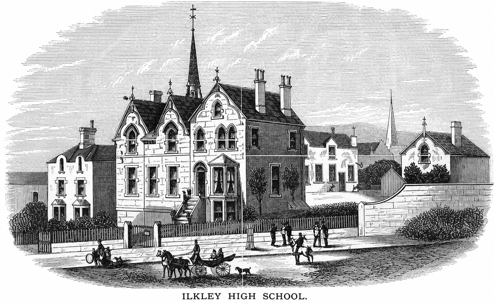
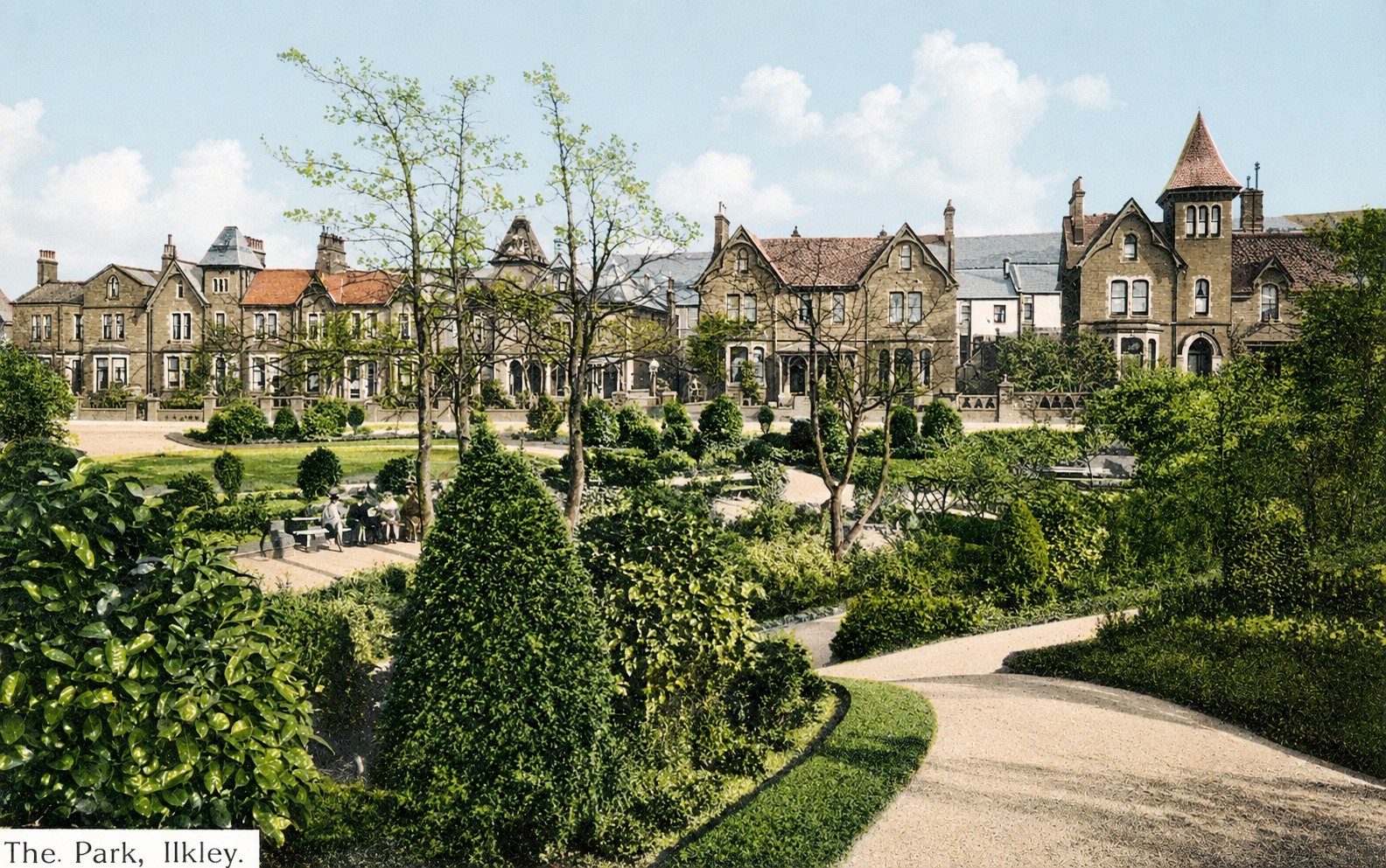
1. Start on The Grove at The Grove Garden, a sensory garden, at the bottom of Parish Ghyll Road. Walk up Parish Ghyll Road. By 1871 this was a gated street described as ‘the Belgravia of the North’ in the Ilkley Gazette. On the left, Dutch-gabled Hopewell Terrace faces the large Netherton semis set in gardens. Near the top of the road on the left, Ilkley High School, erected in 1869 in stone, retains a plaque though the name has been erased. The houses opposite were named to reflect this was once an area of ‘fine oak trees’. On the top left corner is Acorn Mount (Greenways) designed in 1894 by Alex G Adkin. Opposite is a woodland park planted from 1897 for the Diamond Jubilee of Queen Victoria.
 Garden on The Grove looking east
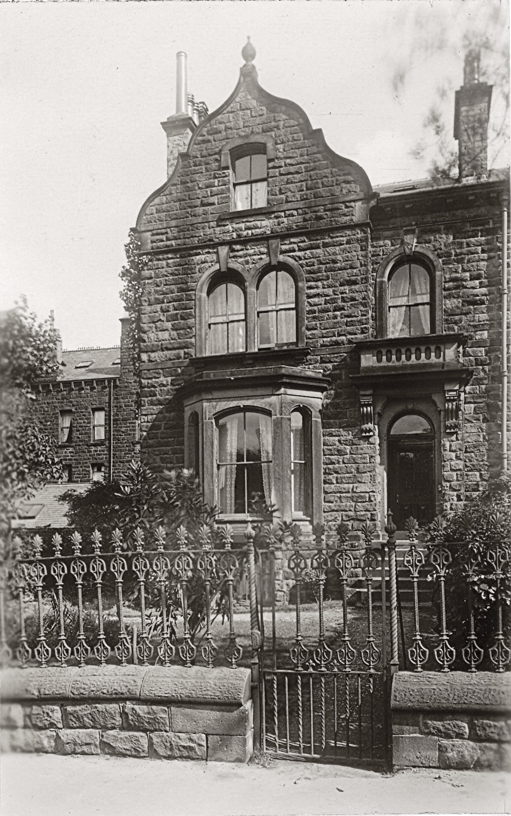 Hopewell Terrace
2. At the top of Parish Ghyll Road turn right to walk along Parish Ghyll Drive. Cross Oakburn Road and continue along Parish Ghyll Drive. On the right is Ashburn House from the late 1860s with a long stone boundary wall. On the left is the boundary wall of 1870 Ferndale, standing at the junction with Princess Road. Ferndale was built by the Leeds architect William Hill for himself. On the right at the corner was a tall oak tree. One Oak House was built in the 1880s. A large garden leads to the stream in the ravine.
 One Oak
3. At the next junction leave Parish Ghyll Drive, turn second left to walk down Wilton Road. These detached semis and large terrace houses were built in the 1890s.
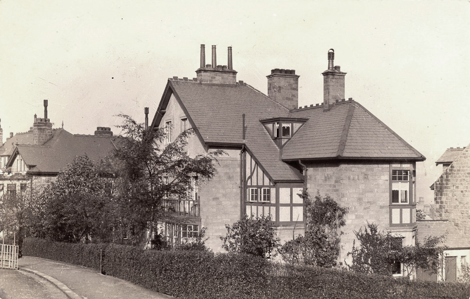 7 Wilton Road
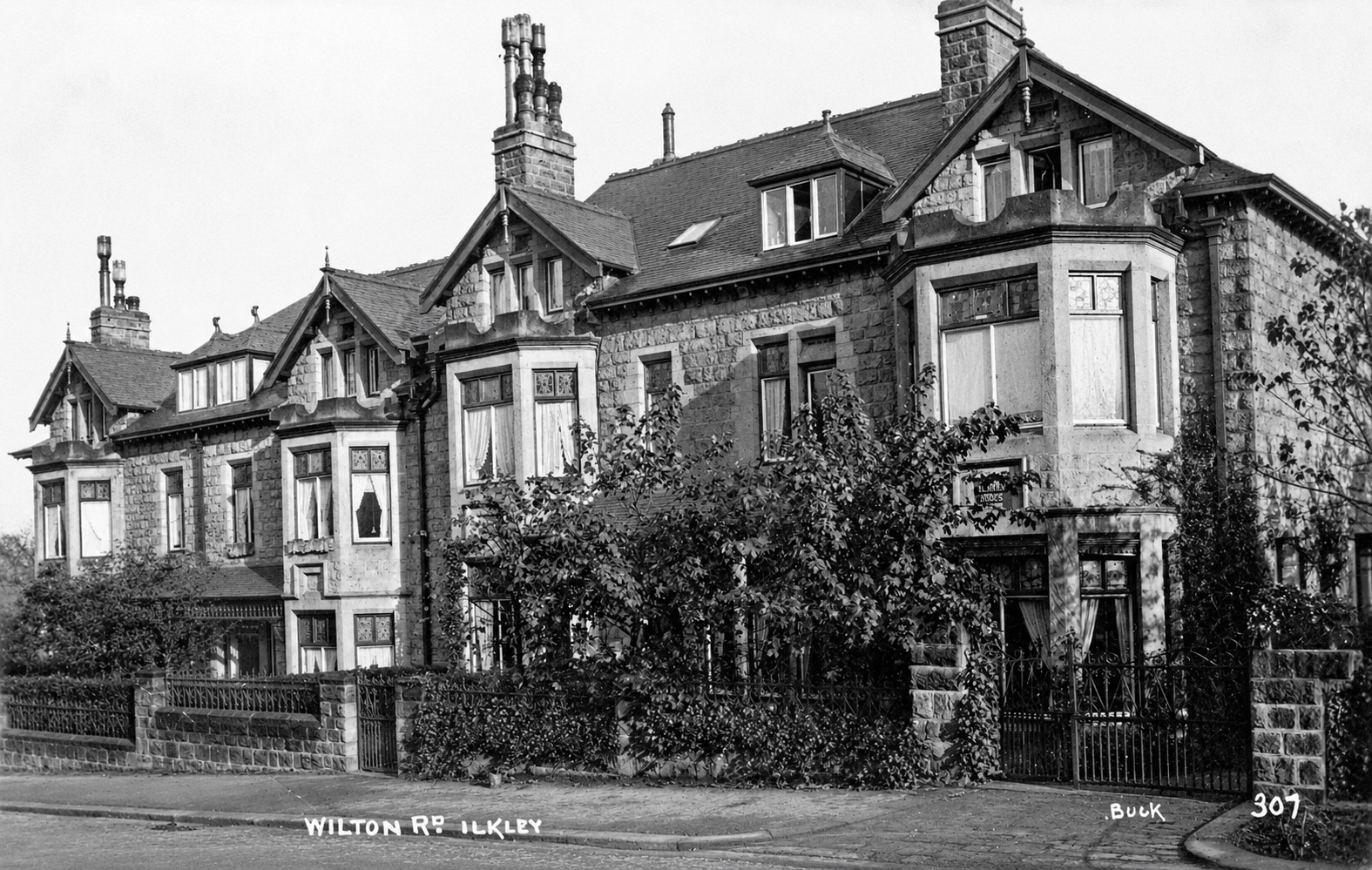 8 Wilton Road Terrace
4. At the bottom of Wilton Road turn left to walk along Grove Road. On the right are the boundary walls of the 1870s Summerfield, home of the Cooke family until the 1930s, and 1890s Warlbeck. On the left are the gardens of 1890 semis and detached Inglehurst from 1880s.
5. At Heath Park turn left and walk up to the middle to look back. Opposite is Heathcote. It was built in 1906-08 on the site of 1880s Rose Mount and Heathcote for JT Hemmingway. He was a successful businessman who, starting as warehouseman, eventually owned Geo. Richardson & Co Ltd - a worsted cloth merchants in Bradford. Heathcote and all its furnishings was designed by Edwin Lutyens. The garden was probably designed by Gertrude Jekyll.
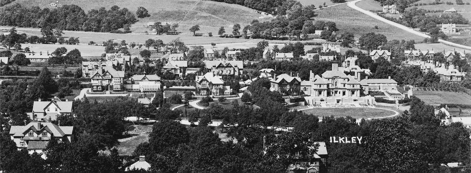 Heathcote to the right (over the word Ilkley) with Rose Mount, Norwood House and Glen Rosa
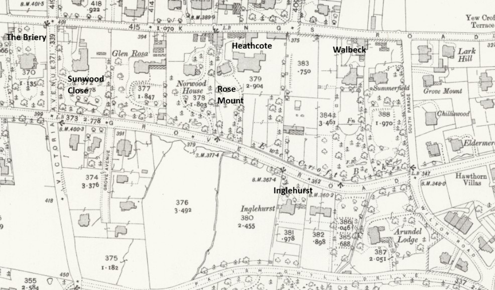
6. Return to Grove Road, proceed west past Shannon Close and Grove Avenue. On the right, after the hedge, is the stone boundary wall of 1890s Southern Hey, renamed as Glen Rosa before 1912, by Mr Ackroyd (see image above). Grove Avenue was built in the early 1900s by Ilkley builders, Pease & Co.
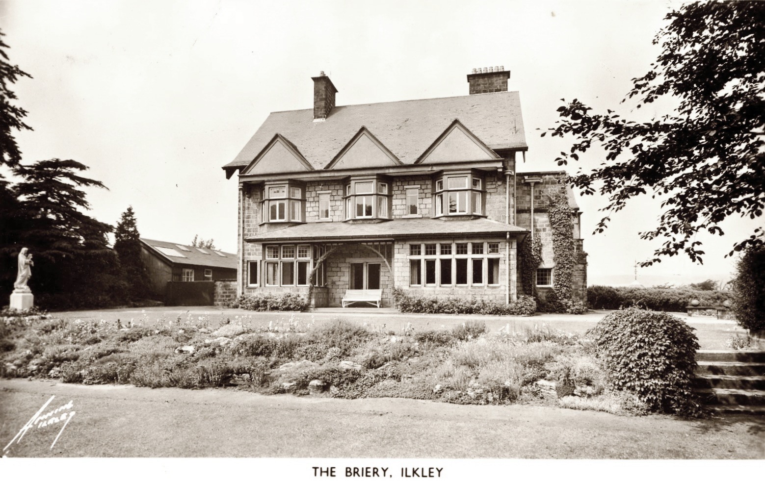
7. At the cross-roads. turn right to walk down Victoria Avenue. Two houses of note - a house on the right, Sunwood, by Milnes & France, and another on the left, the 1898 house, The Briery, for Sidney Kellett by AG Adkin.
8. At the next junction turn right to walk along Kings Road towards Ilkley centre. On the left are mainly 1890s houses designed by Ilkley architect Alex G Adkin. On the right are stone walls from the back of the of the Grove Road houses, including the the rear of Heathcote.
9. Pass Easby Drive and continue along Kings Road. Elmleigh and the other large houses down Easby Drive were built in the 1870s by George Smith. On the right was the 1890s house, Warlbeck, home of FB Muff of Brown & Muff store, Bradford.
 Warlbeck
10. Turn right onto South Parade, and walk to the end to Grove Road. A street of 1870s and 1880s houses.
11. Turn left along Grove Road towards Ilkley centre. On the left is Beck House, then Eldermere from the 1880s in gardens with the diverted Ewe Croft stream. Opposite is the 1880s Hawthorn Terrace and a pair of 1890s semis.
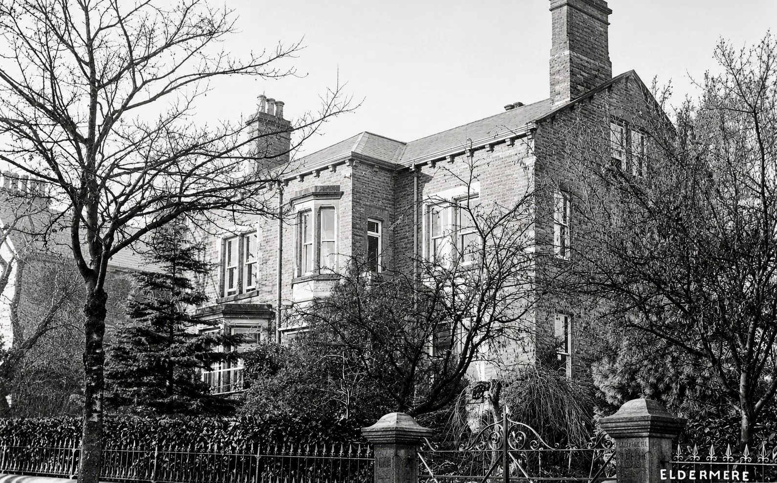 Eldermere
 End of Hawthorne Terrace 37 Grove Road
12. Cross Westville Road and continue on Grove Road. On the left is Ashbrook built in 1890 for Wm. Hepton by AG Adkin, then the 1905 house Morven for Dr T Hearder Brown by Connon & Chorley of Leeds, with the stream edging the gardens.
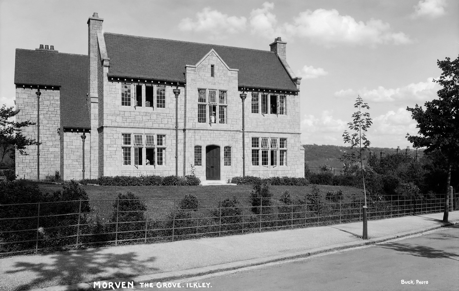 Morven
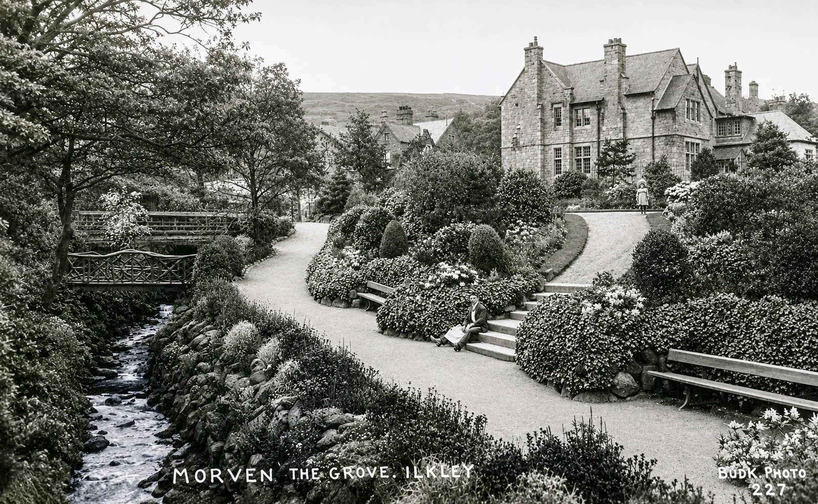 Morven from Spences Gardens
13. As you walk over the bridge look into the 1890s Spence Gardens (perhaps explore the paths, trees and bridges over the stream). On the right is a detached house, a pair of semis and Grove Terrace all designed, with many ornaments, by George Smith in the1870s.
 George Smith designed houses on Grove Road view from Spences Garden
14. Cross Kings Road and follow Grove Road past the War Memorial Gardens then cross over to the left onto The Grove. Here are semis from the 1870s. Notice the dragons on the roof line of Acorn Villas. The Canker Well had a formal drinking fountain from the 1870s. At the rear of the small garden on the left is an 1844 marble trough from Ben Rhydding Hydro. On the other side of Cunliffe Road is the 1890s St James building.
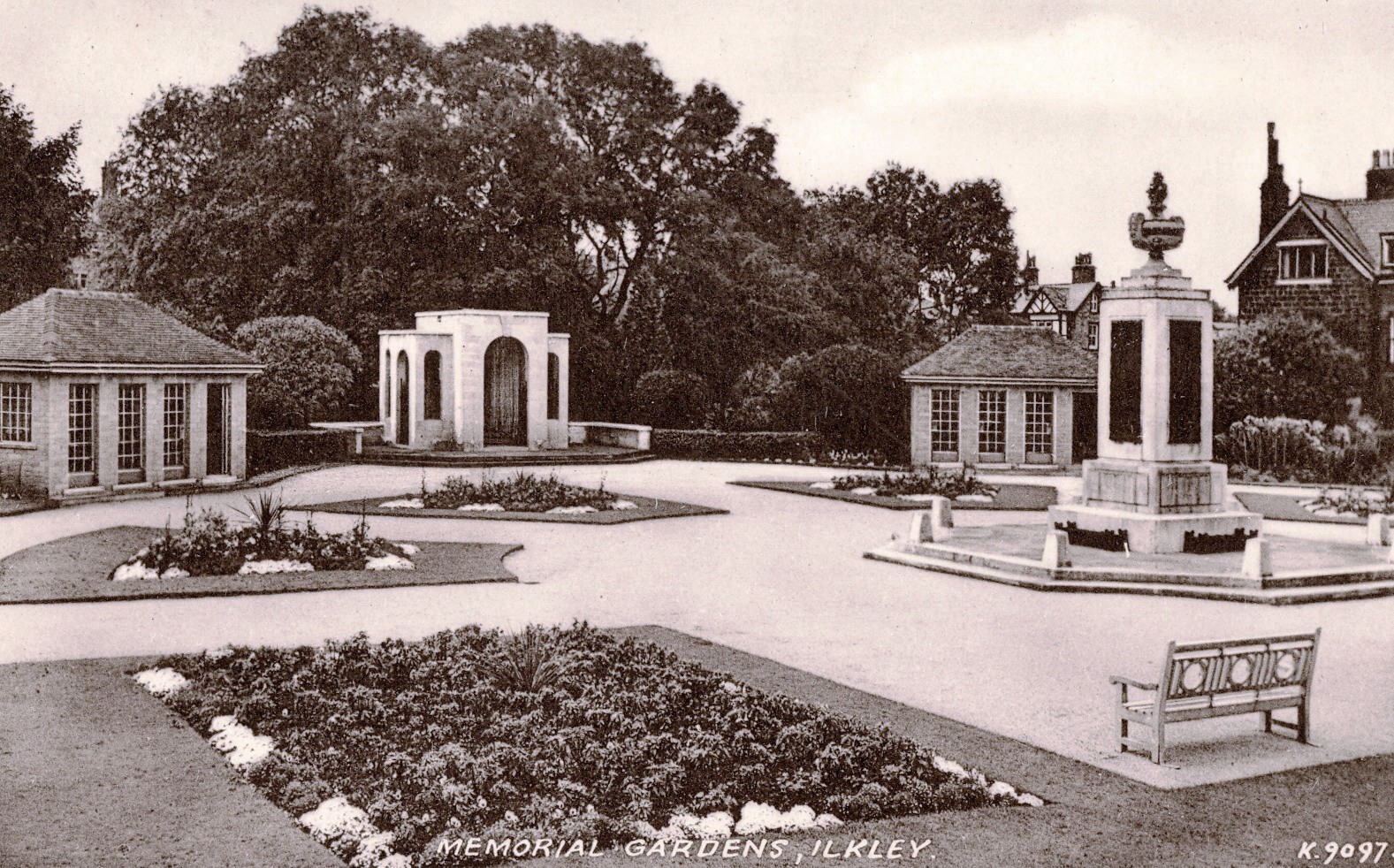 Memorial Gardens
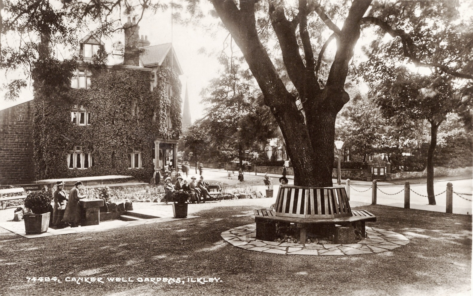 Canker Well Gardens, St James Building behind